
北京遭遇暴雨引发洪水,导致40余人死亡、8万人疏散;卫星显示城乡受灾严重;社交媒体充斥AI生成的假视频;密云区泰式屯镇受灾最重;河北农田被淹超1300公顷。 2025-8-8 15:3:37 Author: www.bellingcat.com(查看原文) 阅读量:36 收藏
Earlier this week, the Beijing authorities placed all 16 of its districts on high alert in anticipation of torrential rain. More than 40 people have since been confirmed dead, and 80,000 evacuated citywide due to the floods.
But what can open source data tell us about the damage caused?
Satellite imagery has allowed us to track the impact on both urban and rural areas. On social media, however, a deluge of AI-generated fakes have continued to draw far more views than many genuine eyewitness videos.
“Gaps” in the city’s readinessIn northeast Beijing, near the largest reservoir in northern China, the highest death toll was recorded in the town of Taishitun. Thirty-one of the confirmed fatalities were from an elderly care home situated near the banks of the Qingshui River, which runs through the town.
Taishitun Village, Miyun District, Beijing. Compares 18/07/2025 to 30/07/2025. Credit: Planet.
Yu Weiguo, a Communist Party secretary for the Miyun District, which includes Taishitun, said at a press conference that there were “gaps” in the city’s readiness.
“Our knowledge of extreme weather was lacking. This tragic lesson has warned us that putting the people first, putting human life first, is more than a slogan,” Yu said.
A loss of food and farmland
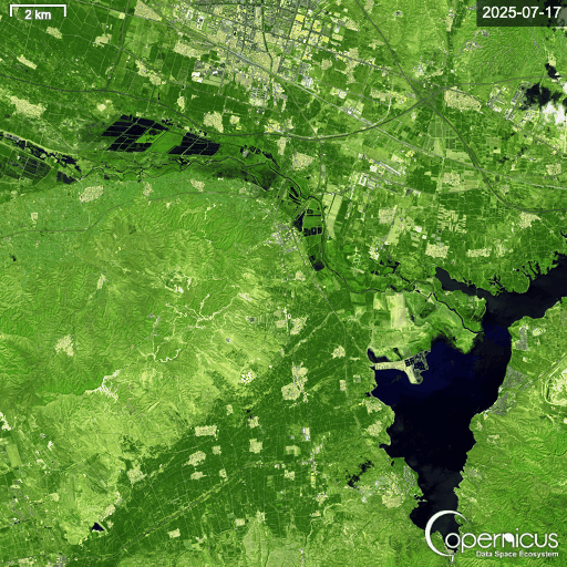
Across Hebei Province, which neighbours Beijing, agricultural land was also heavily affected. In Jiuying Village, more than 1,300 hectares of farmland, much of it low-lying cornfields, was submerged, according to Reuters. Satellite data from the area north and east of Jiuying Village shows the scale of the flash floods.
Jiuying Village, Hebei Province. Compares 17/07/2025 to 30/07/2025. Credit: Planet.
Zooming out even further, Copernicus’ False Colour (Urban) band shows flooded areas in dark blue, highlighting the impact across Hebei Province.
A deluge of AI on Youtube
Yet on other open platforms, such as social media and video sharing sites, the picture became complicated by accounts posting mis-and-disinformation.
Searching in English, the results for #beijingflood on YouTube Shorts revealed multiple AI-generated thumbnails, one of which surpassed 18 million views. Meanwhile, shorts containing real footage struggled to climb past 1,000 views.
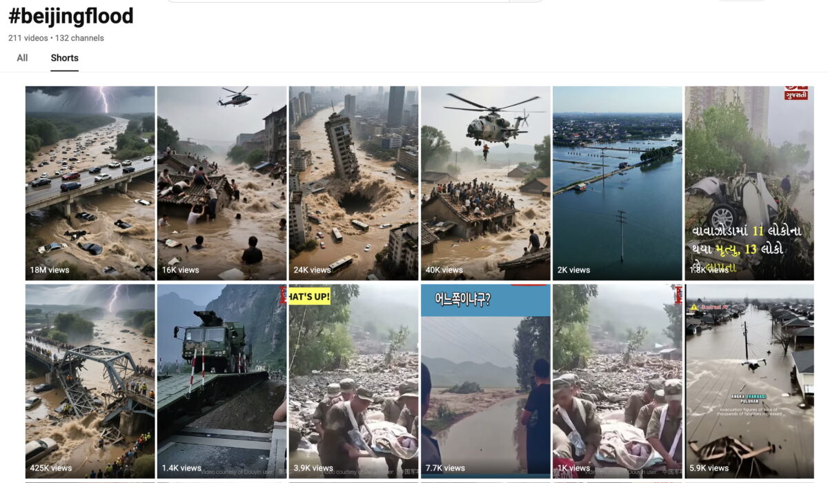
All five of the top results carried the hallmarks of AI generated content: cars randomly appearing and disappearing, disproportionately sized objects, and overly dramatised scenes lasting only a few seconds.
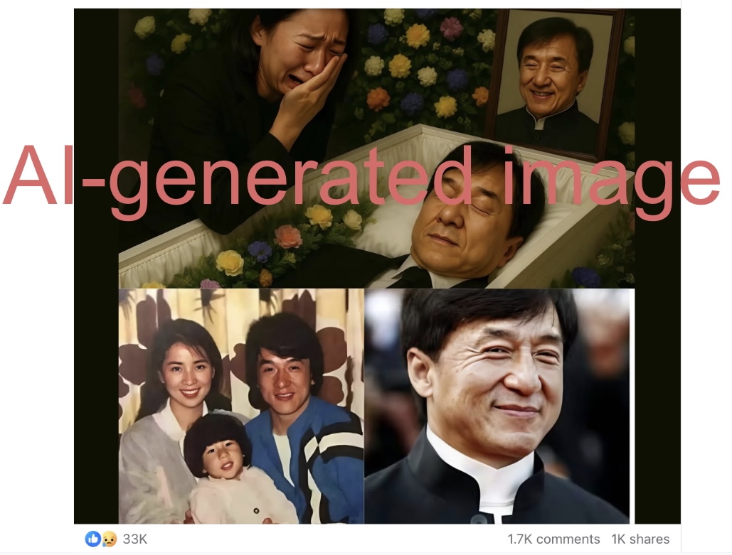
On Facebook, when searching for “Beijing flood,” multiple AI-generated fake posts claimed actor Jackie Chan had died in the floods. Using AI-generated photos of Chan lying in a hospital bed or a casket, these posts collectively gathered more than 150,000 likes.
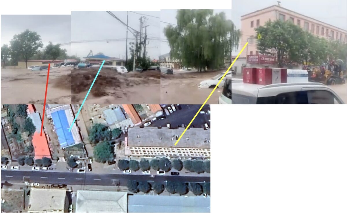
By comparison, Chinese social media platforms, including Baidu’s Haokan Video, Weibo and Douyin appeared to display very few AI-generated videos. Instead, the vast majority appeared to be genuine posts documenting the real-world impact of the floods.
Montage of videos found on Haokan and geolocated by Bellingcat to several districts in Beijing.
Later, in another clip from the same video, a bulldozer can be seen, again not far from the Taishitun government office.
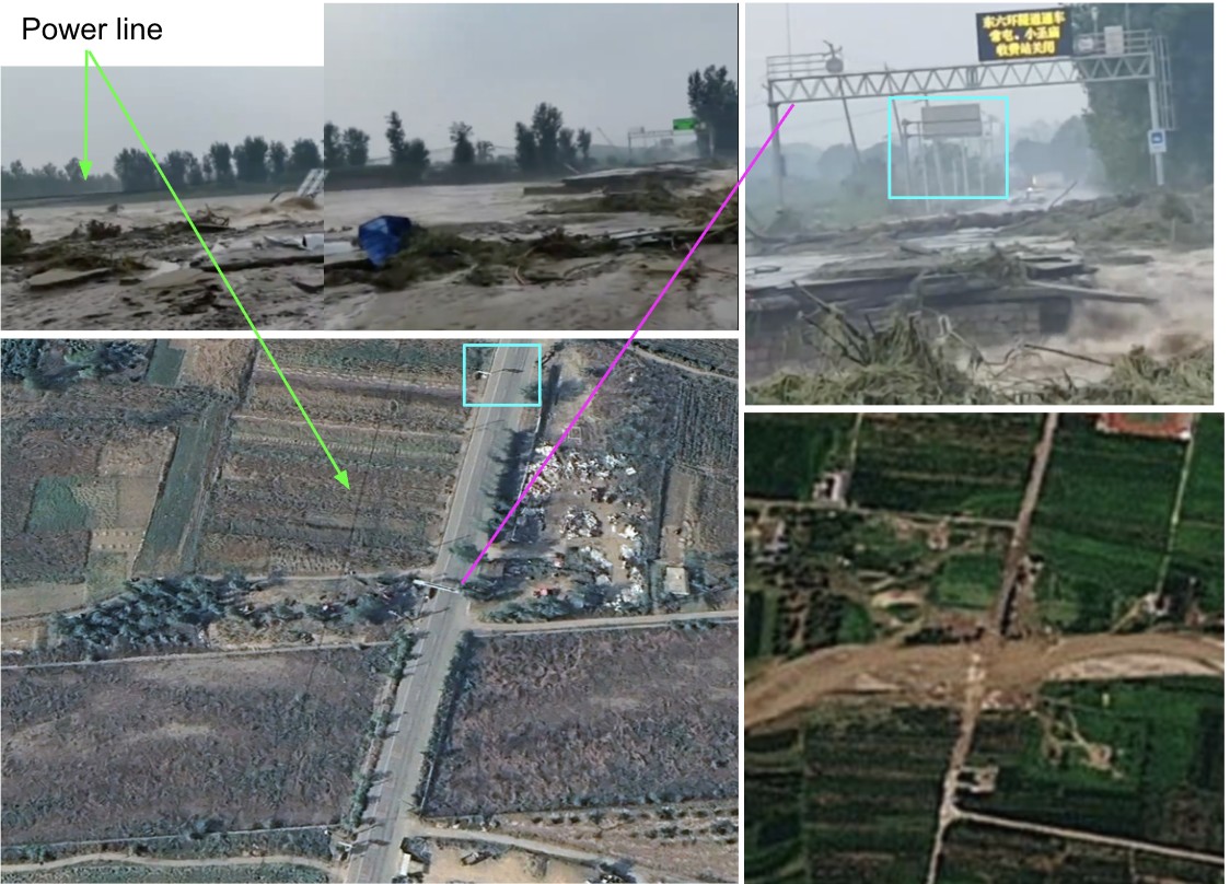
Another video, posted on Haokan, showing a destroyed bridge was geolocated east of Bulaotun Village. The collapsed bridge can also be seen in Planet imagery from 30 July.
Whilst searching Chinese social media platforms, some recycled footage from past floods could be seen. For example, on Douyin, the Chinese version of TikTok, one of the top results when searching for “Beijing flood” was a video from 2021 showing a mudslide in Japan where buildings and trees were engulfed.
如有侵权请联系:admin#unsafe.sh